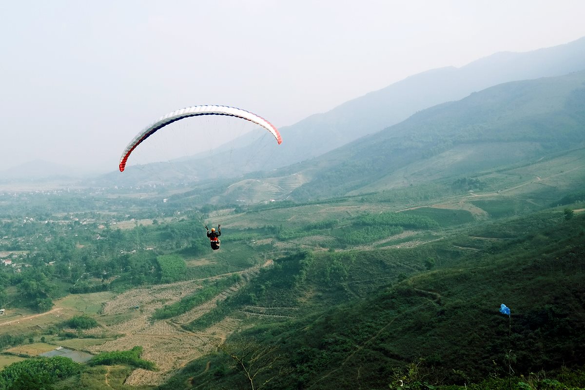
Paragliding is quite a new sport in Vietnam which requires money, time and a lot of technical skills. Vietnam has much potential to develop and promote paragliding since it has very supportive weather, topographic diversity and magnificent scenery from north to south.
Related: Scuba Diving in Nha Trang
This article will introduce you to all the best places to fly in Vietnam with technical information.
In the north
Bu Hill (833 Hill)
The spot is located at Luong Son commune, Hoa Binh province, about 40 kilometres away from Hanoi on the southwest.
- Takeoff coordinates: 20.8086, 105.5686
- Takeoff elevation: 620m
- Landing elevation: 65m
- Takeoff direction: North
- Weather: Windguru. Windyty
The range is narrow with length about 1500m. In windy season, Bu hill is a perfect place for ridge flying (ridge soaring) in light wind conditions and XC flying.
Bai Nha
Bai Nha belongs to Lac Son, Hoa Binh province is the best place to hold annual paraglide competition because it has many favourable conditions of space, weather, and wind.
- Takeoff coordinates: 20.4421, 105.3826
- Takeoff elevation: 480m
- Landing elevation: 60m
- Takeoff direction: North
- Weather: Windguru. Windyty
XC flying is most suitable at Bai Nha because the thermal is always wide and stable. Experts agreed that Bai Nha is the best paragliding spot of not only Vietnam but also Southeast Asia. Bai Nha is also one rare place the pilots in Vietnam choose to come to practice regularly.
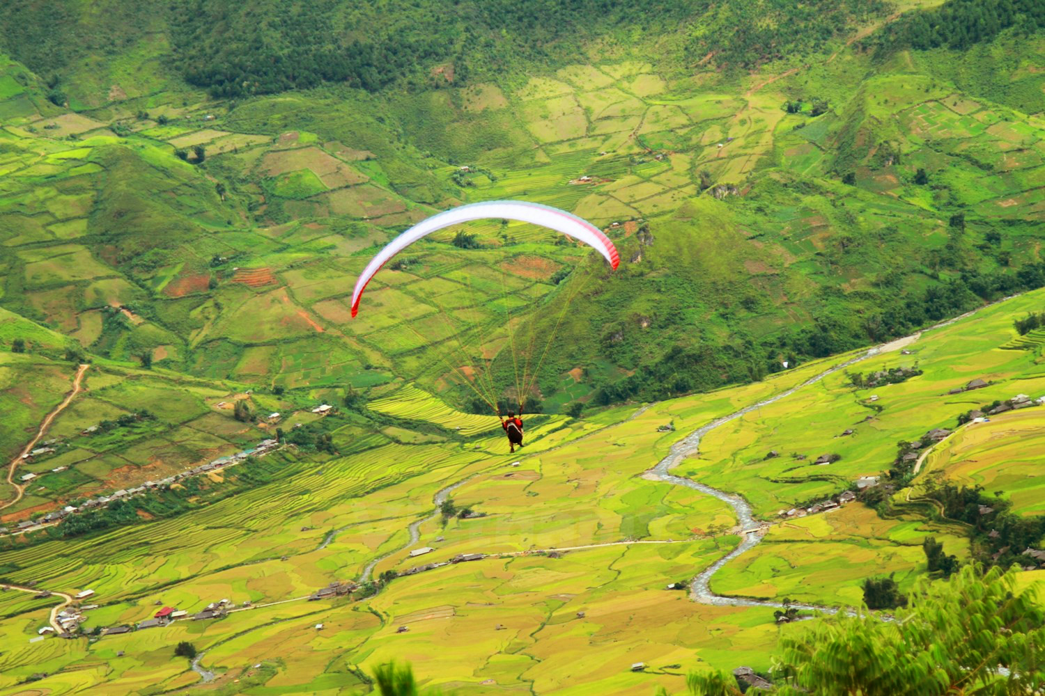
Khau Pha
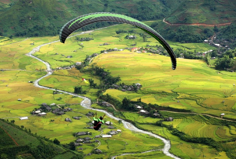
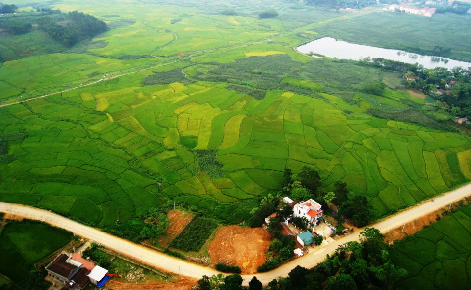
This is the most famous paragliding place in Vietnam, located on the national highway 32 leading to Mu Cang Chai. Every year, from September to October, pilots from all over the country come to Khau Pha to share the sky and the sight of immense golden terraced rice fields below.
- Takeoff coordinates: 21.75533, 104.26593
- Takeoff elevation: 1262m
- Landing elevation: 774m
- Takeoff direction: East and northeast
- Weather: Windguru. Windyty
Another club that is an expert in organizing paragliding activities in Khau Pha is VietWings Hanoi, from 2007. The club holds annual festival named “Fly on the golden season” gathering not only local pilots but also those from foreign countries. There are classes for beginners with experienced coaches Shinji Kake and Jean-Marc Tur.
Mount Vien Nam
Vien Nam is located at Yen Binh ward, Thach That district, Hanoi a one rare paragliding spot near the capital, only 50 kilometres away.
- Takeoff point’s coordinates: 20.98185 N, 105.4436 E
- Takeoff point’s elevation: 260m
- Wind direction: East, Southeast
The height of Vien Nam mountain range gradually increases from 200m to 800m with a length of 2 kilometres, suitable for ridge roaring fly. You have to trek in 30 minutes to reach the top.
U Bo
Another spot locates near Hanoi. U Bo of Tien Xuan commune, Thach That ward is only 42 kilometres away from capital’s centre. The spot was originally found, tested and put into use by Hanoi Paragliding from May 2015.
- Takeoff coordinates: 20°57’52.9″N 105°27’20.6″E
- Takeoff elevation: 451m
- Landing elevation: 100m
- Takeoff Direction: North, Northeast, East, Southeast
The terrain is very suitable for paragliding with Mt. Vien Nam at the back and four takeoff directions. U Bo is perfect for ridge soaring with north and, east and northeast winds and air-born fly with southeast wind. The terrain is also good for thermal fly and SIV practice.
The takeoff field is an area of 2000 square meters with an ideal slope of an altitude of 450m. U Bo is accessible by cars and motorbikes. The landing site is also vast enough.
In the Central
Lang Co
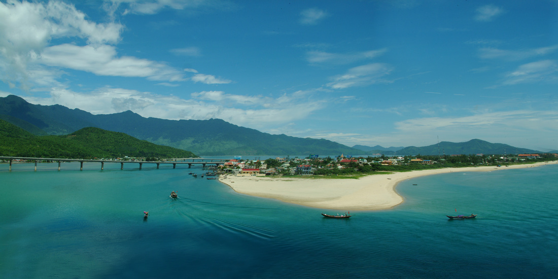
Lang Co beach is no stranger to travellers, being famous since forever for its magnificent scenery and incredible blue beach. Little did they know Lang Co is also the best paragliding spot in the central of Vietnam and is only 30 kilometres away from Danang on the north. If you love this amazing sport and at the same time want to admire the best sightseeing in Vietnam, Lang Co is the best choice.
- Takeoff coordinates: 16.2755, 108.0415
- Takeoff elevation: 200m
- Landing elevation: 0m
- Takeoff direction: East, northeast
- Weather: Windguru, Windyty
Son Tra
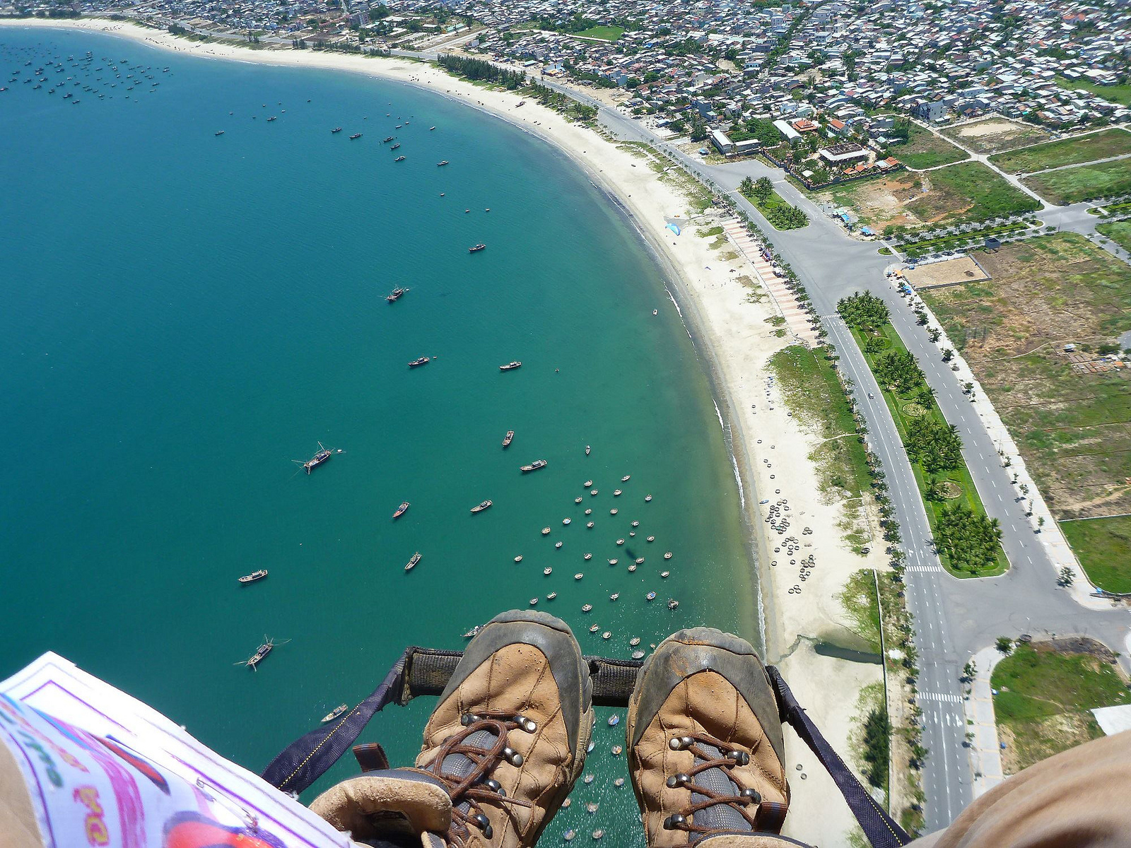
Travellers to Danang are familiar with the name Son Tra. Located at the higher part of the city, you can have the best view of the beautiful Danang bay and the crescent shore from here. The landing site is either Tho Quang beach or Pham Van Dong beach.
- Takeoff coordinates: 16.1179, 108.2738
- Takeoff elevation: 600m
- Landing elevation: 0m
- Takeoff direction: Southeast
- Weather: Windguru. Windyty
Langbiang
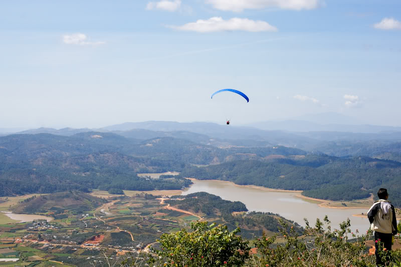
Only 15 kilometres away from the centre of Da Lat, it takes you 20 minutes by bus, motorbike or car to reach Mount Langbiang. This must be the highest paragliding point in Vietnam with an altitude of nearly 2000 meters. Pilots can take a jeep tour to the mountain’s top to save time and energy.
- Takeoff coordinates: 12.0326, 108.4133
- Takeoff elevation: 1800m
- Landing elevation: 1400m
- Takeoff direction: North, southwest
- Weather: Windguru. Windyty
Hon Hong
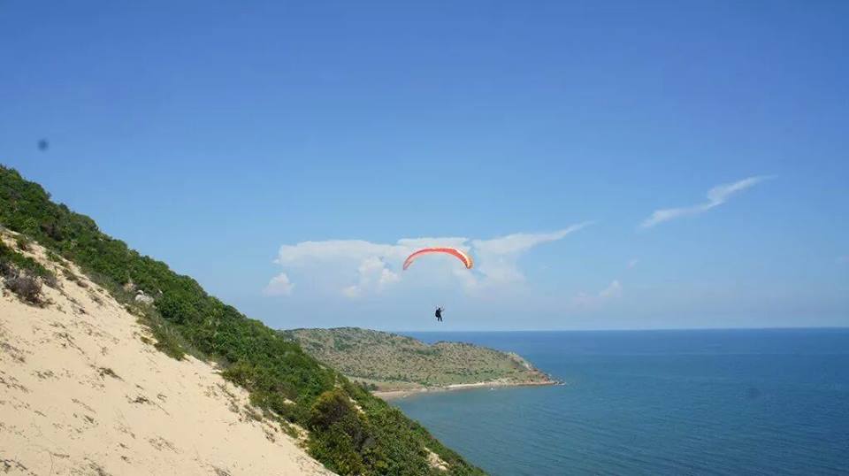
Mount Hon Hong (Pink mountain) is located very near to the famous tourist spot Mui Ne, about 45 kilometres away from the centre of Phan Thiet city. Paragliding activities here are organized by Vietwings, Hanoi Paragliding, and MKPG team (or Mekong Paragliding Club). Many other pilots also come here to practice and enjoy the wonderful scenery of Mui Ne.
The takeoff site is flat, on sand dune and near the beach, enough space for 10 open canopies at the same time. Hon Hong is perfect for beginners and soaring fly.
- Takeoff coordinates: 11.0352, 108.4039
- Takeoff elevation: 200m
- Landing elevation: 0m
- Takeoff direction: South, Southeast